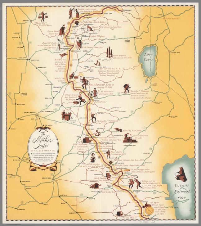
On the way to Yosemite there is a town that hovers right upon that breaking point between ghost town and hamlet. If you drive on Highway 120 you will never see more than a historical marker and perhaps a cool, plant-hidden, maybe-occupied building. But if you stop to walk around, you will find a handful of unoccupied buildings, a few ruins, and neighbors working in their yards. This is Chinese Camp.
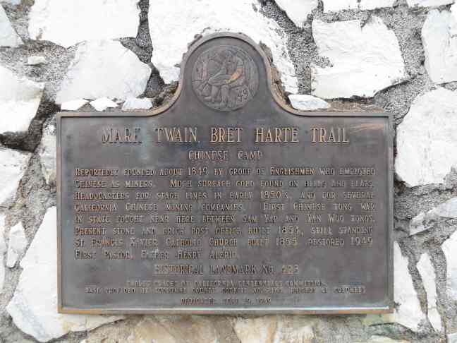
The sign dates to June 19, 1949 and reads:
Chinese Camp
Reportedly founded about 1849 by group of Englishmen who employed Chinese as miners. Much surface gold found on hills and flats. Headquarters for stage lines in early 1850s, and for several California Chinese mining companies. First Chinese Tong war in state fought near here between Sam Wap and Yan Woo Tongs. Present stone and brick post office built 1854, still standing. St. Francis Xavier Catholic Church built 1855, restored 1949. First pastor, Father Henry Aleric.
Actually, most settlements had a sizable Chinese population, many with a “Chinatown” section toward the outskirts of town. This one is unusual in that it was named for this typically mistreated group and there may be more to its significance than the sign and popular histories indicate. To say that the Chinese settlers were treated roughly is an understatement, but we will leave that for a future discussion. The point here is that they did much and are typically left out of the histories except as footnotes where mining and railroad construction are concerned. Make no mistake, however, there would have been a very different gold rush/rise of agriculture/late-19th century in California if it were not for the hard working immigrants from China and its neighbors.
As for the current town of Chinese Camp, it provides a satisfying stop to stretch your legs. Just past the historical marker there is the ruin of the Bruschi Store. It is partially occupied by a modern metal shed, but this ruin seems to have been ruined for much longer than it was a store.


Across the street is a wood frame house that has also seen some changes. Note the two-story porch. Today it is a bit more modest.


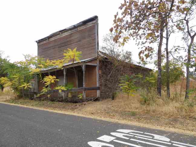
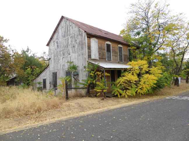
A few steps further down the road is the old post office. This is the building referred to on the historical marker along Hwy 120. It seems it was periodically opened to the public up until at least 1993, but now appears permanently shuttered.


Next to the post office is a building noted as the Rosenbloom Store in the 1948 DOM book. Its roof has changed, and it lost a wall or two along the way, but the façade remains.


You may notice pairs of green, metal shutters on the brick-front buildings. These metal, often iron, shutters are a common feature throughout California’s gold country. Window glass was expensive and fragile in the 19th century. Therefore, it was limited to small panes (think gridded windows on old houses) and used sparingly on the frontier. When the goal was to build cheaply, quickly, and securely, and to avoid being burned down in the frequent fires that swept through town, stone, brick, and metal were the best choices. The stone was quarried nearby. Brick was expensive so it was used only on the important parts (fronts mostly). And any openings were secured with metal shutters, typically painted green. The shutters made it difficult for unwanted visitors as well as fire to plunder the building.
Two other buildings of note on this small stretch of street are on the opposite side of the street. The first is a one-story, false front building. Stepping back to view the side wall of this structure, it is hard not to be impressed with the audacity of the designer. They took the concept of false front to its extreme here.
The other is at the intersection with the rest of town. This wood frame, two-story building appears to have once been a hotel or boarding house. It is architecturally more ornate than the others with carved window trims. Such tactics were employed to suggest a respectable, more high class sort of establishment. Whether this was the truth or not I have not been able to discern.
Here is a website with photos from 1993 and scans from a 1971 book showing many of these same buildings.
There are other structures in Chinese camp, scattered amidst the homes and modern establishments of the current residents. It was beginning to rain so our trip was limited to this one, most easily accessed, street directly off 120. On a future trip I plan to see a bit more of this once robust town. If you are in the area, it is worth a few minutes detour.
Note: All references the Department of Mines 1948 book (also noted at DOM 1948) officially refer to Jenkins, Olaf P. State of California Division of Mines Bulletin 141: The Mother Lode Country: Geologic Guidebook Along Highway 49 – Sierran Gold Belt, Centennial Edition. San Francisco: State of California Division of Mines, 1948.