This is the time of year when there is weather, vacations, and lots of food. In my book, these are all valid reasons to get out of the house whenever you can so that you don’t go hurt the ones you love and/or drown your misery in cookies/ pack on the pounds. It is also the time of the year when the hills in northern California become spectacularly green and the air is clear and crisp. With all of this in mind, here are a few suggestions to see something a bit out of the ordinary, if only for a few hours between the rains. They are listed in no particular order. Some are all day activities, others only take a few hours. All are great with kids but are not kid-specific sorts of places. In other words, if you get an afternoon sans the kids, check them out too.
GHOSTTOWNS AND MINING AND CAVES, OH MY! – Black Diamond Mines Regional Preserve
$5 parking, $5 mine tour
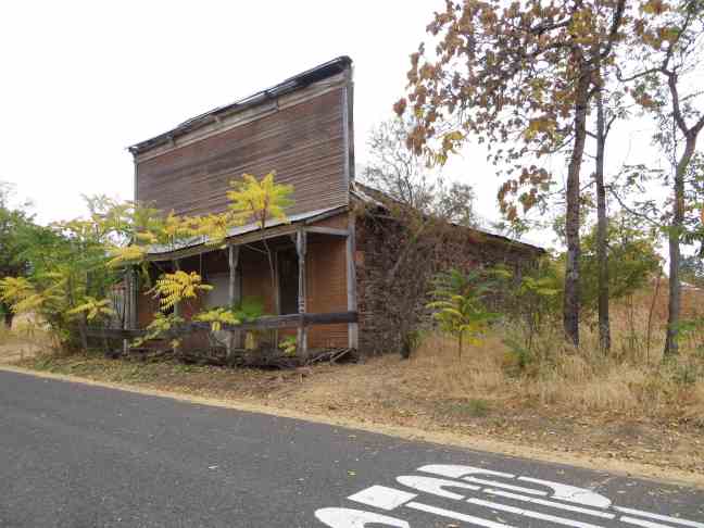
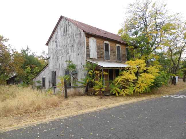
150 years ago there existed 5 towns within the confines of this gem of a regional park. All were associated with coal mining in the eastern foothills of Mt. Diablo. At the time, it was the regional epicenter of commerce and activity. It’s hard to think of a town with a population of 1000 as a metropolis but that is exactly what it was. Yep, that was truly a wilder time. Today you can hike any number of scenic trails into steep, grassy canyons, explore the remains of a town or two, visit a pioneer cemetery, and even go inside a mines and caves. See my earlier post about Black Diamond Mines if you want.
If you can, try to schedule your visit to coincide with the Hazel-Atlas mine tour. (It’s seasonal so call ahead, $5 per person tour fee.) On the 90 minute tour you will go deep into a sand mine. Yep, they mined sand here, for an Oakland glass company. That is just one of the many very cool historical and geological tid-bits that you’ll pick up along the way.
It’s best for the winter months when the weather is cool and the hills are green. In the summer it is blistering here. The downside is that mine tours don’t happen in the winter. However all the guides and rangers we encountered were eager to show something interesting to the kids and they have yet to disappoint. Three trips so far to this park and we are just getting started.
Side Note: For an interesting drive, continue east on 4 past Antioch and head into a bit of the San Joaquin Delta. Just the bit from Antioch to Stockton will give you a taste of what this wider area might have looked like during your grandparents’ youth.
WATERFALL WILDERNESS – Sunol Regional Wilderness
$5 parking
This park is great all year but is especially wonderful when the rains start to fall. First of all the drive there is a treat, taking you back into lands you never knew existed. Then there is the amazing rolling topography, complete with grazing cows, wide vistas, curious rocks, and loads of wild flowers. BUT the biggest reason to visit this park in the winter is the Little Yosemite area of the park. Think water roaring over smooth boulders, deep pools of crystal clear water, mountain meadows (toward the upstream side), and tons of great nooks for snacks and picnics.
If you like mud, this is also a park for you. When it rains, the trails can be quite messy, especially when the cows are nearby. Did I mention the open grazing within portions of the park? We had one curious Bessie follow us for a bit last February. The distraction kept the kids going for at least a half-mile between snack breaks.
Depending on your crew and their taste for adventure, the straightest path to Little Yosemite Valley is less than a mile long, along a fairly flat and level gravel road. For something more heart-pumping, you can combine a number of trails to extend the journey as long as you wish. I suggest a longer journey as you wander to the falls, then taking the short and straight path back. After the roar of the water and the thrill of climbing over boulders, hiking becomes much less fun. (The kids are tired and the parents are tired of hearing them whine.)
OLD SCHOOL, SO COOL – Mt. Hamilton/Lick Observatory
Visitor Center and Book Shop open Thursday-Sunday, 12-5, and the entire week between Christmas and New Years
This site holds so many personal delights for me. The scenery is gorgeous. It is historic. It is very science-y. And it reminds me of the few special times when I was one of those astronomers, sleeping in a dorm and eating lunch at midnight. It’s a story for later but observatories are special places. They just are. Period.
It’s historic and one of a kind. It was first completed in 1888 when San Jose truly was 30 miles away and light pollution was something no one had thought of just yet. Back then, buildings had ornament, and the architectural design was as aesthetically pleasing as it was functional. The Lick Observatory is a prime example. (It has been evaluated multiple times for inclusion on the National Register of Historic Places but does not appear to be officially recognized as a historic resource. It’s time to make it official, folks.)
The complex sits on the top of Mount Hamilton at an elevation of just over 4,200 feet. This makes it the tallest peak in the Bay Area and a frequent bucket list entry for local cyclists. The drive there goes through park and ranch land, winding ever so slowly up a reported 365 narrow switchbacks. It might not be good for those prone to carsickness or for faint-hearted drivers. For everyone else it is a bit thrilling and quite beautiful.
The trip up to Mount Hamilton and the walk around the grounds is a great day-trip. There are frequent talks, numerous displays, and occasional special programs that bring the modern science of astronomy within reach of the average curious mind. The views alone justify the 1+ hour drive from San Jose.
A word of warning though. Get gas and food before you start climbing up CA 130. There are no gas stations and the “café” consists of vending machines and a k-cup machine for hot drinks. So prep accordingly and you will be perfectly prepared to throw caution to the wind and try the 2-hour drive down the back side on CA 130 east to Livermore. WOW! Let me repeat that. WOW! This road can’t be believed. If you love exploring, and driving, and feeling a bit lost in the best possible way then take this drive. Also, it is not for those prone to car sickness. You’ve been warned.

SHORT AND SWEET – Dunsmuir House
Grounds open Tuesdays – Fridays, 11-6 pm except on public holidays. House tours are offered April – September at 11 am – $5 for adults. Call for special event hours and pricing.
Parking is free but limited.
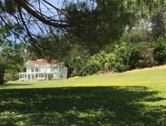
This is a City of Oakland park at the southern end of Oakland, just off 580. It can’t be seen from the highway and signage is a bit lacking, and that is what makes it feel like a secret find. Park along the street near the East Bay Regional Parks Headquarters and walk through the iron gates onto the landscaped grounds. Portions of the park feel lush, like a private garden from story books. Other parts of the park have a more, well, abandoned, Secret Garden, sort of feel. A paved drive/path wanders through the landscape, bringing you past a pond, a blindingly bright white mansion, ruins of a former pool house, and several other areas both modern and original to the estate.
Built in 1899, this grand estate was a private residence until it was purchased by the City of Oakland in the 1960s. Now the 50-acre property is a public park with special holiday events (Easter egg hunt, Christmas tea, etc.) and available for weddings. The building itself has been featured in several movies. My favorite is So I Married an Ax Murder (1993) where it served as their honeymoon destination – The Poet’s Corner.
What is nice about this park is that once you are on the grounds, it is like stepping back in time. There are views only of the little valley in which the park sits – no highways, no modern buildings, no houses even. There is ample shade and easy access too, perfect for a picnic, for lounging quietly, or for little ones to run and play in the wide grassy lawns.
Don’t expect tons of benches or water fountains or other sorts of amenities that might be found at a typical city park. This still appears as a private estate, only one that you can visit for free provided you can get there during their somewhat limited hours. Plus, it is super close and just a little bit unexpected.
LAND HO! – Bay Area Ferries
Oakland to San Francisco is $6.60 each way for adults or $5 with your Clipper card. Kids are half that.
Not sure what you want to do other than get out of the house and experience something different? Take a ferry. They run from all sorts of locations, most have parking nearby (but be sure to check on the commuter lot rules/hours), and some even serve food and drinks on board. Why drive to San Francisco when you can motor along on the water? It makes the journey magical and it gives a whole new perspective on old familiar landmarks. Plus you can relive the glory-days of ferry travel before the bridges were built.
For example, did you know…
- The San Francisco Ferry Building handled over 100,000 passengers per day before the Golden Gate Bridge (1937) and San Francisco Bay Bridge (1936) were completed.[1]
- At its height in 1930, 43 ferry boats operated between the two sides of the bay.[2]
- Getting from Oakland to San Francisco by ferry takes approximately 30 minutes.
- You can take a ferry to see the Giants play baseball.
Personally, I recommend leaving from Jack London Square in Oakland at sunset and returning after dark to see the lights on the Bay Bridge for a no effort, very romantic (hint hint) date night. It also works for cranky kids, especially if you throw in dinner at the Ferry Building or at Jack London Square to sweeten the deal. Not the cheapest outing but it is definitely unique and it requires no planning.
There are ferries to/from Fairfax, Sausalito, Vallejo, and other points. Seasonally they run to Angel Island from the East Bay, or year round from Tiburon. The point is that they go more places that you might think.
There are so many distractions in the Bay Area that sometimes the hardest thing is to pick just one. Hopefully some of these are surprises and inspire a sense of adventure and curiosity for this amazing place to call home. We can all use a bit more unexpected wonder in our lives, particularly at this time of the year. Enjoy!
[1] San Francisco Ferry Building National Register Nomination, 1978.
[2] Website: A Brief History of Ferries on the Bay…


